
Unearthing a Smarter Future How Digital Innovation is Revolutionizing Underground Infrastructure

Ever faced costly project delays or, worse, dangerous utility strikes due to unseen underground hazards? 💣 In today’s rapidly urbanizing world, especially within complex, expanding cities, what lies beneath is no longer a mystery we can afford. For Engineers, real estate developers, and construction leaders, accurate underground mapping isn’t just a luxury it’s the critical foundation for success.
Unearthing a Smarter Future How Digital Innovation is Revolutionizing Underground Infrastructure
At APPLY AND MORE CO., we see this every day. Flying blind is not an option when you’re building the future.
Seeing Beneath the Surface: Our Comprehensive Infrastructure Intelligence
Imagine having a crystal-clear, digital view of every critical system hidden underground. Our “Infrastructure Intelligence” service delivers exactly that. We meticulously survey and document:
- 💧 Internal water networks
- 🚽 Sewage systems
- ⚡ Electricity grids
- 🌐 Communication and Fiber optic lines
- 🔥 Gas distribution networks
- 🛠️ Other essential underground utilities
We capture crucial specifications: material types, pipe dimensions, pressure ratings, and maintenance access points. This precision isn’t just data; it’s power – power to ensure effective project planning, robust risk mitigation, and streamlined maintenance for years to come.
The Tech That Powers Precision: Our Advanced Toolkit
To achieve unparalleled accuracy, APPLY AND MORE CO. deploys a suite of cutting-edge technologies, managed by our specialized professionals:
- Original Construction Records (As-Built Drawings): The foundational truth for initial installation data.
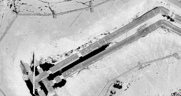
- Ground-Penetrating Radar (GPR): Advanced, non-invasive radar pulses to image the subsurface – see what’s buried without disruptive digging
.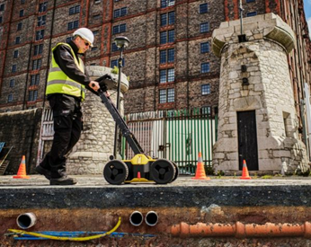
- Electromagnetic Locators (EML): Efficiently detecting metallic utilities, crucially enhancing safety by preventing accidental strikes.
- Subsurface Utility Engineering (SUE): A rigorous engineering process, collecting and interpreting underground data for informed project decisions.
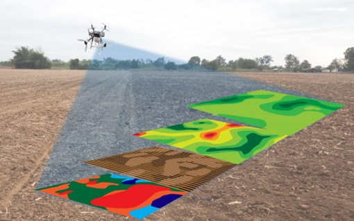
- Geographic Information Systems (GIS) & High-Precision Navigation (RTK GPS): Sophisticated systems for precise spatial data collection, seamlessly integrated into comprehensive project databases.
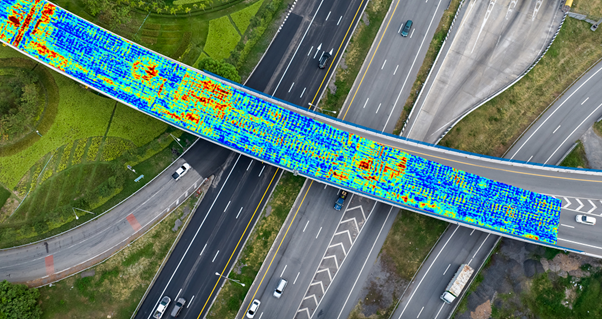
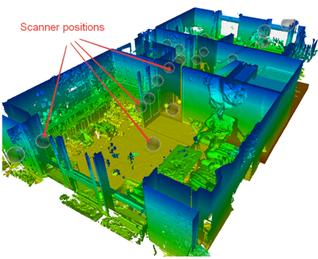
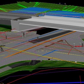
- 3D Laser Scanning (LiDAR): State-of-the-art tech providing highly detailed 3D images of underground structures, essential for precise design alignment and clash detection.
Real-World Impact: How This Drives Your Project Success
- The value of precise underground infrastructure intelligence translates into tangible benefits across your projects:
- Stop Costly Damage: Drastically reduce the risk of damaging critical utilities, preventing expensive interruptions and major safety hazards.
- Accelerate Development: For residential and commercial developers, seamlessly integrate new projects with existing infrastructure, significantly speeding up design and construction phases. Get to market faster!
- Smarter Design, Flawless Planning: Equip your engineers and designers with comprehensive underground data to enhance project designs, optimize routing, and boost overall project feasibility.
- Streamline Permitting: Precise, detailed mapping helps satisfy municipal requirements quickly and effectively, accelerating your permitting process.
- Future-Proof Your Assets: Support robust asset management with accurate, real-time infrastructure data, facilitating sustainable urban growth and intelligent expansion.
Building Resilient Cities: From Static Records to Dynamic Intelligence
In an era of rapid urbanization and technological leaps, accurate underground maps are indispensable. They are the bedrock of smart, safe, and sustainable cities.
At APPLY AND MORE CO., we elevate this further. We don’t just map; we integrate Building Information Modelling (BIM) and Digital Twin technologies into our infrastructure solutions. These aren’t just fancy terms; they mean:
- Intelligent 3D Models: Representing current underground assets with pinpoint accuracy.
- Lifecycle Simulation: Simulating future interactions and performance to anticipate challenges.
- Predictive Maintenance: Shifting from reactive fixes to proactive care.
- Real-Time Monitoring: Keeping a live pulse on your infrastructure.
- Data-Driven Decisions: Empowering you with actionable insights.
This transforms urban development from reactive to proactive, from static blueprints to dynamic, living intelligence.
APPLY AND MORE CO.: Powering Visions Across Egypt & The Gulf
Our strategic implementation of these advanced solutions is already making a tangible impact across Egypt, the GCC, and the broader Gulf region. We are proud to actively deploy GIS-BIM integration and Digital Twin platforms in alignment with visionary national strategies like Egypt Vision 2030, Saudi Vision 2030, and the UAE’s smart city agendas.
From Riyadh’s groundbreaking mega-projects to Cairo’s dynamic urban redevelopment, and Abu Dhabi’s pioneering sustainable initiatives, APPLY AND MORE CO. services are:
- Enhancing digital readiness
- Optimizing asset lifecycles
- Ensuring resilient and intelligent city planning
These efforts directly fuel the ambitious goals of smart city development, particularly under initiatives like Saudi Vision 2030, which champions digital transformation and sustainable infrastructure. By embedding digital engineering intelligence deep within infrastructure systems, we help create the data-rich, adaptable urban environments that are the very essence of tomorrow’s smart cities.
With APPLY AND MORE CO., underground networks cease to be hidden risks. They become strategic, intelligent assets shaping the cities of the future.

Ready to Unearth Your Project’s Full Potential?
- Follow Us: Stay ahead of the curve! Follow APPLY AND MORE CO. on LinkedIn for more insights into digital construction, BIM, Digital Twins, and sustainable infrastructure development.
- Learn More: Curious how our Infrastructure Intelligence can transform your specific project? Visit our website
- Join the Conversation: What are the biggest underground infrastructure challenges you’re currently facing or foresee in the industry? Share your thoughts in the comments below!


