The Power of Integrating Geographic Information Systems (GIS) and Building Information Modeling (BIM)
Unlocking The Power Of GIS And BIM Integration
The Power of Integrating Geographic Information Systems (GIS) and Building Information Modeling (BIM)
In today’s rapidly evolving Architecture, Engineering, and Construction (AEC) industry, the integration of Geographic Information Systems (GIS) and Building Information Modeling (BIM) has emerged as a game-changer. This powerful combination is reshaping the way projects are planned, managed, and executed, offering new levels of efficiency, cost savings, and innovation. This article will explore the key benefits, challenges, and applications of GIS-BIM integration and why it matters in the AEC industry.
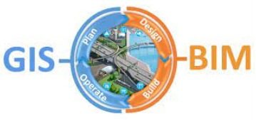
What is GIS-BIM Integration?
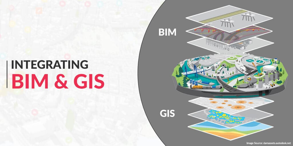
Integrating GIS and BIM brings together geospatial data (GIS) and detailed building information (BIM) to enhance decision-making, planning, and analysis. While GIS focuses on the geographic context, such as terrain and environmental factors, BIM provides detailed building data, including design, materials, and performance. By combining these two technologies, project teams can visualize buildings in their real-world context, improving outcomes across the project lifecycle.
Key Benefits of GIS-BIM Integration
1. Enhanced Visualization and Communication
Integrating GIS and BIM allows stakeholders to visualize building projects within their geographical environment. This enhanced visualization leads to better communication between project teams, clients, and other stakeholders. When buildings are seen in the context of their surroundings, it becomes easier to understand the impact of design choices and make more informed decisions.
2. Advanced Spatial Analysis
Combining geospatial data with building models opens up new possibilities for spatial analysis. Whether it’s evaluating potential sites, planning infrastructure, or assessing environmental impacts, GIS-BIM integration provides the tools to make data-driven decisions. For urban planning, this means smarter, more resilient cities. For infrastructure projects, it means optimized placement and resource management.
3. Streamlined Project Workflows
GIS-BIM integration helps eliminate data silos and promotes seamless data exchange throughout the project lifecycle. This streamlining of workflows reduces delays, minimizes errors, and enhances collaboration across teams. By ensuring that all data is accessible and interoperable, project teams can work more efficiently and focus on delivering high-quality results.
4. Increased Efficiency and Cost Savings
The integration of GIS and BIM leads to more accurate project estimation, optimized resource allocation, and improved risk management. These factors directly contribute to cost savings, increased efficiency, and faster project completion. For companies in the AEC industry, this translates to a competitive advantage and better financial performance.
Challenges of Integrating GIS and BIM
Despite the clear benefits, integrating GIS and BIM is not without its challenges. These include:
1. Data Incompatibility
GIS and BIM data often come in different formats, which can create challenges when trying to integrate them. To address this, industry standards and frameworks are being developed to ensure interoperability, but organizations must still invest in the necessary tools and expertise.
2. Technical Complexity
The technical demands of GIS-BIM integration require specialized knowledge in both domains. Companies need to provide training and development for their teams to successfully implement and manage integrated systems.
3. Legal and Privacy Issues
Integrating spatial and building data raises privacy concerns and legal challenges. Organizations must ensure compliance with data protection regulations and establish clear governance policies to safeguard sensitive information.
Applications of GIS-BIM Integration
The integration of GIS and BIM is already proving valuable in several key areas:
1. Urban Planning and Smart Cities
GIS-BIM integration is essential for urban planners who need to analyze the potential impact of new developments on existing infrastructure. By visualizing proposed projects in the context of the city, planners can make better-informed decisions to create sustainable and resilient urban environments.
2. Infrastructure Management
For infrastructure projects, GIS-BIM integration offers valuable tools for asset tracking, maintenance planning, and disaster response. This leads to more efficient infrastructure management and helps ensure that assets are well-maintained and resilient in the face of challenges.
3. Facility Management
Facility managers can use GIS-BIM integration to optimize building operations, enhance maintenance strategies, and improve energy efficiency. This integration provides a comprehensive view of facilities and enables smarter decision-making.
4. Environmental Analysis
The combination of GIS and BIM allows for more accurate environmental analysis, including ecological modeling, land-use planning, and natural hazard assessments. This helps organizations reduce their environmental impact and contribute to more sustainable development practices. Unlocking The Power Of GIS And BIM Integration
Conclusion
The integration of Geographic Information System (GIS) and Building Information Modeling (BIM) offers substantial benefits for the AEC industry. From improved visualization and spatial analysis to streamlined workflows and cost savings, this integration is reshaping the way projects are delivered. However, overcoming the challenges of data incompatibility, technical complexity, and privacy concerns is crucial for successful implementation. As more organizations embrace GIS-BIM integration, they will unlock new possibilities for innovation, sustainability, and growth.
For companies looking to stay ahead in the competitive AEC landscape, investing in GIS-BIM integration is not just an option—it’s a necessity.


